Services

DFlyit: Skyborne Precision Mapping
Revolutionizing Spatial Insights with Drone Technology
Welcome to DFlyit, where precision meets innovation in Geographic Information System (GIS) mapping and surveying services. As a leading authority in drone technology, we bring forth a cutting-edge approach to transform the landscape of GIS applications.
Our GIS mapping services redefine spatial data analysis, providing accurate and detailed information for a multitude of industries. From land surveying to infrastructure planning, DFlyit’s drone-enabled GIS solutions offer unparalleled precision, efficiency, and versatility.
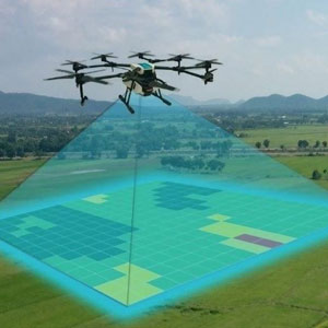
Utilizing state-of-the-art drone technology, our team of certified pilots navigates the skies to capture high-resolution imagery and geospatial data. We specialize in creating comprehensive maps, conducting detailed surveys, and generating actionable insights for informed decision-making.
At DFlyit, we understand the dynamic nature of GIS requirements across diverse sectors, from agriculture and construction to environmental conservation. Our commitment lies in delivering tailor-made GIS solutions that not only meet but exceed our clients’ expectations.
Whether you are in need of topographic mapping, land-use planning, or environmental monitoring, DFlyit’s GIS mapping and surveying services provide a transformative edge. Join us as we redefine the possibilities of GIS technology, contributing to a future where precision and innovation converge seamlessly. Explore the world from above with DFlyit – where every detail matters, and every map tells a story.

